I came back up to Alta this evening and decided it would be the perfect late afternoon for a quick adventure. Most of my time is spent on the American River for a number of reasons, not least being access, but the story of these ridges is flanked by two rivers of equal importance and beauty. The Bear River runs NE to SW, parallel to the American River, but north one ridge, or two or three or four when you get to the high country and the watershed fingers out into smaller, more abundant canyons. There aren’t many ways to access the Bear and the limited number of locations involves some serious adventure driving.

The main road out to Lowell Hill Ridge and Mule Springs – the spine of Lowell Hill Ridge being one of the original routes of the Emigrant Trail – passes over one of a number of levees on the Bear. To the southwest is Steep Hollow Crossing, once connecting to Red Dog Rd. and Nevada City, but the bridge has been long washed away. I’ll go into Steep Hollow and the Little York diggings at a future time. Rollins Lake is to the southwest and further to the northeast is Drum Power House. Smart’s Crossing is the next and only way to get to the Bear up stream of the Dutch Flat access until Drum Powerhouse itself. The canyons are insanely steep because the river cuts through hard metavolcanic rock. This stuff is late-Paleozoic (299 – 359 M years ago) schist, the greenstone that occurs in the Calavaras Complex and that has been associated with gold deposits since the old days. This is the same tough rock that forms Giant Gap just south on the American River, a near vertical formation on both sides of the river creating a tight aperture at the southwest end of Green Valley due to the hardness of the rock.

Further upstream to the northeast the river crosses at nearly a right angle the serpentine belt of the Melones Fault zone, separating Mesozoic rocks to the west and Paleozoic rocks to the east in the southern portion of the belt and bounded by Paleozoic rocks on both sides in the northern portion. The northern portion is considered to be older, though the whole fault is of high tectonic significance, with a complex character. Further upstream yet lies the metasedimentary rock of the Shoo Fly Complex, which is early-Paleozoic and older than 419 million years. These sedimentary rocks were formed deep underwater, long before North America existed, as clays settled to the ocean floor. Picture the sort of odd scientific illustrations of Cambrian arthropod creatures, Trilobites, on an alien ocean floor with alien flora and fauna. It’s so hard to wrap one’s head around the scale, scope, and timeline of the processes that formed that ocean mud into metasedimentary rocks 500 million years later. I have barely pieced enough of this story together to retell it, but that’s why we’re here right, to learn?

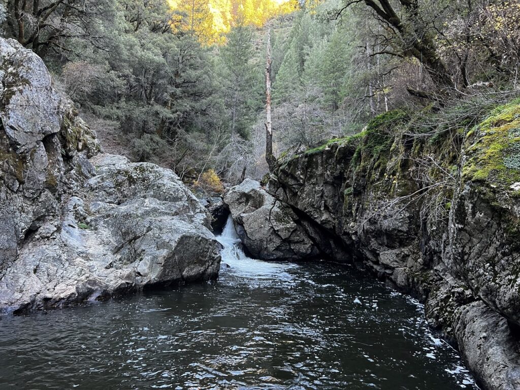
Smart’s Crossing is place of historical significance and was once the center of a legal battle between private property owners who gated the road and the People, particularly the people who have been recreating at this spot for generations since Europeans arrived and most certainly before that by local tribes. The crossing was named after the Smart family, lumber mill owners from Dutch Flat and provided access to Liberty Hill on the other side. This portion of the river made for a good crossing because it is narrow; as a result, there is a deep pool and waterfall, with a jumping rock about 20 feet above the water. In the end, the property owner was sued, and the gate came down, but many historic and public roads have met worse fates. Because PG&E operates the power house and dam upstream, they again closed off the road in the early 2000s because of liability around water releases. They too were reminded of the ruling that this was a public road. Again, the gate came down and access remains today.

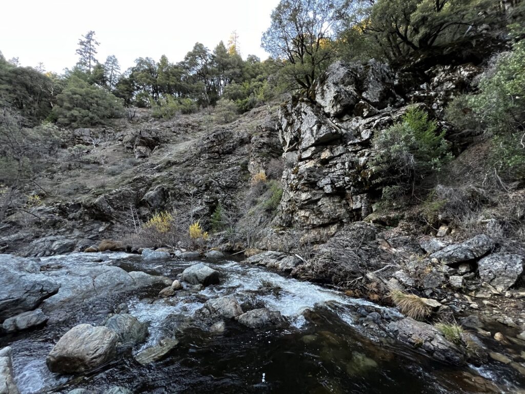
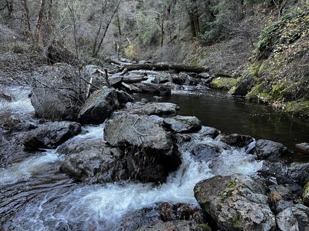
There have been many mining claims down there since the early days, but it seems that activity has picked up recently and someone is exercising their claim. I don’t remember seeing claim signs when I would go down there on a sweltering summer day to jump off the rock into the frigid water. It’s just a gorgeous spot and I wanted to see it this time of year. Because of the active claims, any desire I had to turn a few rocks over or swing my metal detector were dashed. Alas, I scrambled upstream on the mossy, treacherous rocks to snap some photos and see what was there to be seen. Across the river are visible remnants of the intricately cut and set rocks that made up the road, forming a curiously straight rock wall in the middle of nowhere to the uninformed visitor. On the surface of the greenstone remains a massive steel bolt anchored in the rock from the bridge, gone since the 1930s.

As it was late in the day and the deep canyon sunset was upon me, I scrambled back up the last portion of narrow road that is now un-drivable to my car and rambled my way up the rutted, neglected road and back into civilization. Next time I am down there, it will be warm enough to swim.
